

Stock News•6 days ago
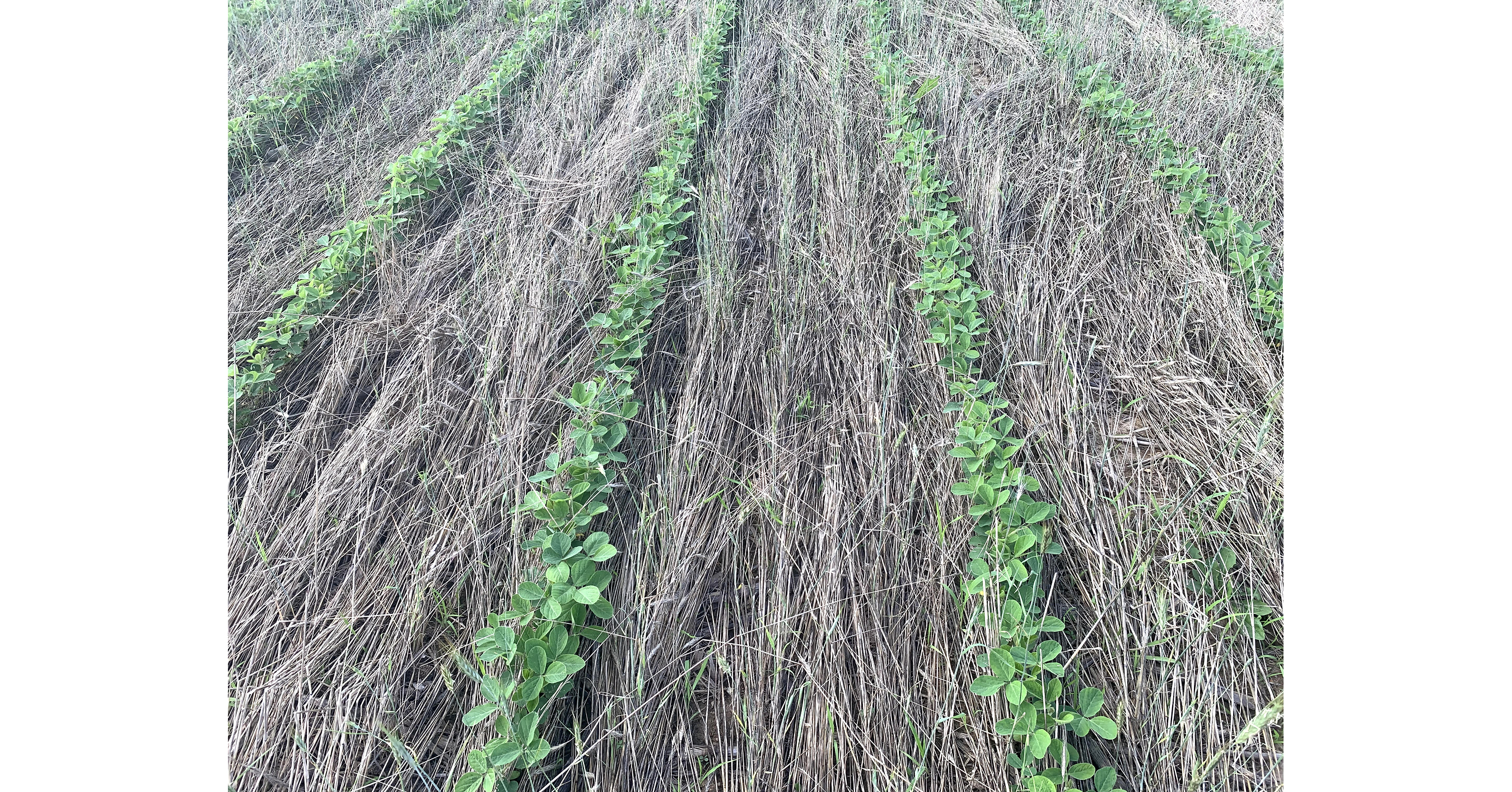
High Rye Seeding Rates Prove Effective for Weed Suppression
A WSSA journal published research showing high cereal rye seeding rates effectively suppress weeds, offering a potential alternative to chemical herbicides.
Key Takeaways
The agricultural sector stands at a critical juncture, facing the dual pressures of feeding a global population projected to reach 10 billion by 2050 and mitigating the escalating impacts of climate change. This immense challenge necessitates a 40% increase in food production over the next three decades, pushing traditional farming methods to their limits. Enter precision agriculture, a paradigm shift that is redefining how food is grown, moving from broad-stroke management to highly targeted, data-driven interventions.
Precision agriculture, often dubbed "smart farming," integrates advanced tools like GPS, sensors, drones, data analytics, and artificial intelligence (AI) to optimize every facet of crop production. This isn't just about boosting yields; it's about fundamentally improving resource management, enhancing water efficiency, reducing waste, and significantly limiting negative environmental impacts. It transforms decision-making, enabling site-specific management that improves both profitability and sustainability across global agricultural regions.
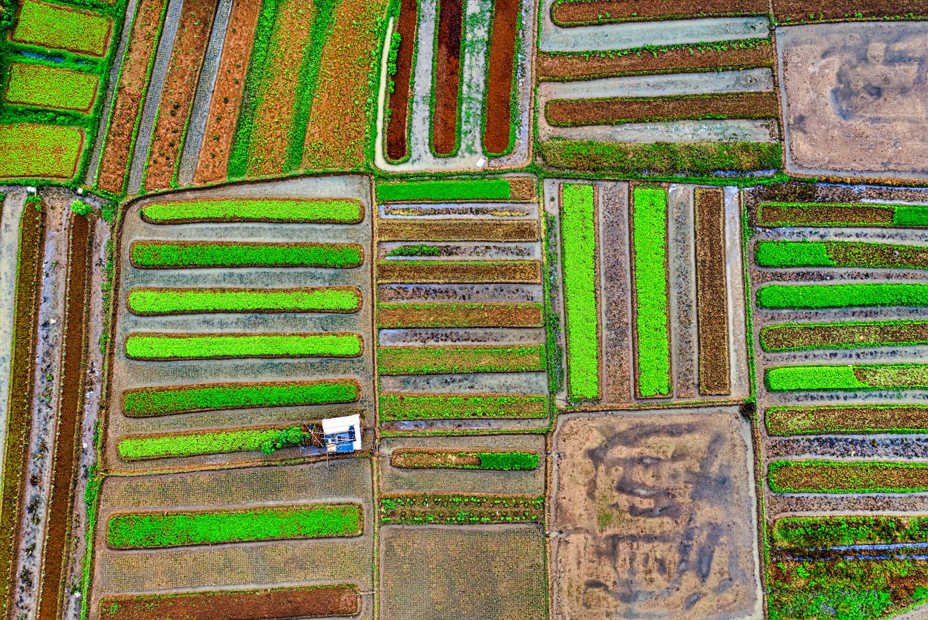
The shift from manual, reactive scouting to proactive, data-informed strategies is profound. Historically, farmers relied on walking fields and making educated guesses, a slow and labor-intensive process that often resulted in delayed interventions and suboptimal outcomes. Satellite-based crop monitoring, however, empowers farmers with precise, timely, and large-scale insights into crop conditions, leading to better decisions, increased productivity, and more sustainable practices. This digital transformation is not merely a trend; it's fast becoming the standard, with over 70% of large crop farms expected to utilize satellite-based precision farming technologies worldwide by 2026.
This revolution is driven by the urgent need for accurate, timely crop status information to achieve high yields and minimize losses. Healthy crops are the bedrock of food production and farm economic stability, yet they are constantly under threat from drought, pests, diseases, and nutrient deficiencies. Early detection of crop stress is paramount, preventing minor issues from escalating into major problems that can devastate harvests. Satellite technology provides a scalable and efficient solution for continuous monitoring across vast areas, a capability traditional methods simply cannot match.
The core of this agricultural revolution lies in sophisticated satellite technology, particularly high-resolution, high-frequency imagery solutions. Companies like Planet Labs are at the forefront, deploying constellations of satellites that image the Earth daily, collecting over 350 million square kilometers of imagery each day. This unprecedented frequency and broad area coverage are crucial, allowing farmers to measure crop health from preseason to harvest, even in regions with frequent cloud cover, ensuring no critical changes go unnoticed.
These satellites capture multispectral data, which is then analyzed to assess various vegetation indices, most notably the Normalized Difference Vegetation Index (NDVI). NDVI visualizations provide an objective, scientific measure of plant health and vigor, highlighting areas of stress or robust growth that are invisible to the naked eye. This granular, field-level detail, combined with rapid access to data via cloud-based APIs, means insights can be easily integrated into existing software pipelines, making them actionable for farmers and agribusinesses.
The resolution of these images is also a key differentiator. Planet's 3.7-meter resolution satellite imagery stream, for example, enables precision digital agriculture and pest detection at scale. This level of detail allows for informed crop management decisions, from identifying specific areas needing irrigation or fertilization to detecting early signs of disease outbreaks or pest anomalies. The ability to monitor crops via satellite and AI, as demonstrated by platforms like Farmonaut, transforms decision-making by providing site-specific management recommendations.
Beyond optical imagery, the integration of AI, machine learning, and big data analytics is pivotal. With the explosion of data from satellites, drones, and IoT sensors, AI-powered decision-support systems turn raw data into actionable insights. These advanced algorithms automate crop classification, stress detection, and yield prediction, reducing the need for technical expertise while significantly increasing accuracy. This combination of cutting-edge satellite hardware and intelligent software creates a full-spectrum view of crop health, from space to soil, enabling proactive farm management and optimizing every input.
The adoption of satellite-based precision agriculture technologies translates into a powerful combination of economic benefits for farmers and significant environmental gains for society. These innovations go beyond simply boosting crop yields; they drive a fundamental shift toward more sustainable farming practices by enabling targeted input use and vastly improved resource efficiency. The numbers are compelling, demonstrating a clear win-win scenario.
One of the most immediate and impactful benefits is the reduction in resource use. Farmers can see typical fertilizer reductions of 10–30% with no loss of crop yield, and a January 2026 synthesis in Nature reviewing 444 studies found climate-smart technologies decrease fertilizer use by 36%-60% while maintaining average crop yields. This directly lowers costs, with a 1,000-acre row crop farmer potentially avoiding as much as $20,000 in additional fertilizer expenses. Herbicide costs can also be reduced by roughly $12,000 for the same acreage. This targeted application minimizes runoff and limits environmental pollution, protecting surrounding ecosystems.
Water efficiency is another critical advantage. Satellite-guided irrigation systems ensure crops receive the exact amount of water needed, promoting water conservation and reducing overall usage by an estimated 5%. Technologies like soil moisture sensors and more effective scheduling systems ensure water gets to the right places at the right times, without compromising crop health. Furthermore, precision agriculture helps reduce fuel consumption by an estimated 7%, saving a 1,000-acre farmer roughly $4,000 annually. This is achieved through equipment telematics for better management and auto guidance for improved operational efficiency, leading to a smaller carbon footprint.
The impact on crop yields is equally impressive. Satellite imagery analytics can lead to an estimated increase in crop yield of 8–15%, while drone-based monitoring, which complements satellite data, can boost yields by 10–18%. By addressing nutrient or moisture limitations precisely, every plant can reach its full potential. Beyond yield and resource savings, these technologies improve soil health by minimizing over-tilling and excessive input use, supporting soil structure, fertility, and biodiversity. The net result is not just higher profitability for farmers but also a substantial reduction in greenhouse gas emissions, making agriculture more resilient and environmentally responsible.
The market for agricultural monitoring satellite imagery is a dynamic and evolving landscape, characterized by a mix of established aerospace giants and innovative tech startups. Companies like Planet Labs, EOS Data Analytics, Earth-i, UrtheCast, and Satellite Imaging Corporation are pivotal in shaping the future of precision farming, each bringing unique strengths to the table. The global agricultural monitoring satellite imagery market size is expected to reach $710 million by 2032, growing at a 5.2% CAGR during the forecast period of 2026-2032. The North American market alone is projected to grow annually by 9.6% (CAGR 2026-2033), underscoring the significant opportunities.
Planet Labs, founded in 2010 and headquartered in San Francisco, California, is a prominent player with its extensive constellation of 450 satellites. Their strategy focuses on creating a global stream of daily satellite imagery, which can be fed into various applications, offering high-frequency data and foundational analytics. In 2022, Planet Labs reported approximately $100 million in revenue, highlighting its strong market position. This broad coverage and rapid access to data are key differentiators, especially for large-scale precision agriculture.
EOS Data Analytics excels in satellite-based crop monitoring, analyzing high-resolution imagery to track vegetation indices, soil moisture, and pest activity. Their solutions deliver precise insights, enabling farmers and agribusinesses to manage fields effectively and boost yields, offering variable rate application recommendations and detailed field reports. Other significant players include Earth-i, focusing on high-resolution imagery with advanced data analytics, and UrtheCast, which combines satellite imagery with analytics for yield predictions and resource optimization. Companies like Trimble also offer precise point positioning (PPP) technology, such as Trimble RTX®, providing real-time, high-accuracy positions via satellite or internet.
The competitive edge often comes from the integration of satellite data with other precision agriculture technologies. While satellite imagery provides the macro view, its combination with drones (UAVs) for high-resolution field-level detection and IoT-based soil and environmental sensors for hyper-local insights creates a comprehensive "space to soil" monitoring system. This synergistic approach, coupled with AI and machine learning for predictive analytics, allows companies to offer more robust, actionable solutions. The market is also seeing increased partnerships and collaborations aimed at integrating these diverse data sources for better analytics, driving innovation and expanding market reach.
Despite the undeniable benefits and robust market growth, the widespread adoption of satellite-based precision agriculture technologies faces several significant hurdles. One primary challenge is the initial investment cost. While the long-term returns are clear, the upfront capital required for sophisticated hardware, software subscriptions, and integration services can be a barrier for many farmers, particularly smallholder operations. Although open data initiatives and mobile-friendly platforms are making satellite farming trends more accessible, bridging this financial gap remains crucial for broader penetration.
Another key obstacle lies in data integration and the complexity of analytics. Farmers, while skilled in agronomy, may lack the technical expertise to effectively utilize the vast amounts of data generated by satellites, drones, and sensors. The "common mistake" of using Variable Rate Technology (VRT) systems without high-quality, up-to-date field data underscores this point; outdated or incomplete information can lead to suboptimal input placement, negating the very efficiency gains precision farming aims to achieve. Developing user-friendly interfaces and robust decision-support systems that translate complex data into simple, actionable advice is paramount.
Furthermore, connectivity and infrastructure remain a challenge in many rural agricultural regions. Reliable internet access is essential for transmitting large volumes of satellite data and accessing cloud-based analytics platforms. Without adequate infrastructure, the real-time insights promised by these technologies can be hampered, limiting their effectiveness. The need for seamless data flow from space to soil, and then to the farmer's device, requires a robust digital backbone that is not universally available.
Finally, the market is highly competitive, with numerous players vying for market share. While competition drives innovation, it also means companies must continuously differentiate their offerings through superior resolution, frequency, analytical capabilities, or integration services. The future of agri-tech is being shaped by innovations that will make satellite monitoring even more powerful and accessible, including advanced AI for automated crop classification and stress detection, and deeper integration with climate-smart farming strategies. Overcoming these challenges will require continued technological advancements, supportive policies, and educational initiatives to empower farmers with the tools and knowledge needed to fully embrace this transformative era.
The trajectory for satellite-based precision agriculture is unequivocally upward, driven by an urgent global need for food security and environmental stewardship. This isn't just about incremental improvements; it's a fundamental re-engineering of agriculture, making it smarter, more efficient, and inherently more sustainable. The integration of high-resolution satellite imagery, advanced AI, and real-time data analytics is creating a future where every acre is optimized, every drop of water is conserved, and every nutrient is precisely applied.
As climate variability intensifies, these technologies will play an increasingly crucial role in climate-smart farming, helping farmers adapt through predictive forecasts, soil moisture monitoring, and seasonal trend tracking. The continued advancements in satellite technology, coupled with innovations in AI and data integration, promise a future where every farmer—regardless of farm size or location—can benefit from precision insights delivered from space. This convergence of technology and agriculture is not merely a technological marvel; it is a vital investment in our planet's future and the economic resilience of farming communities worldwide.
Want deeper research on any stock? Try Kavout Pro for AI-powered analysis, smart signals, and more. Already a member? Add credits to run more research.